Monday, October 10, 2011
Mt. Catawba, mile 700 on the AT
At the point where the AT crosses VA 311 just south of Catawba VA, is mile 700 of the trail. It's a popular trailhead for section hikers and day hikers alike. It's also about 1/3 of the total distance of the AT, a humbling fact indeed.


Sunday, October 9, 2011
The Home Place

 At least there is a reward for all that hard work traversing Dragons Tooth and the rest of the AT. In the little town of Catawba VA sits The Home Place restaurant, in business since 1982. It's food is famous in hiker lore. Good southern cookin, all-you-can eat 3 meats and sides. Load her up!!
Best country food I've had since my grandma Eve.
The Dragon's Tooth
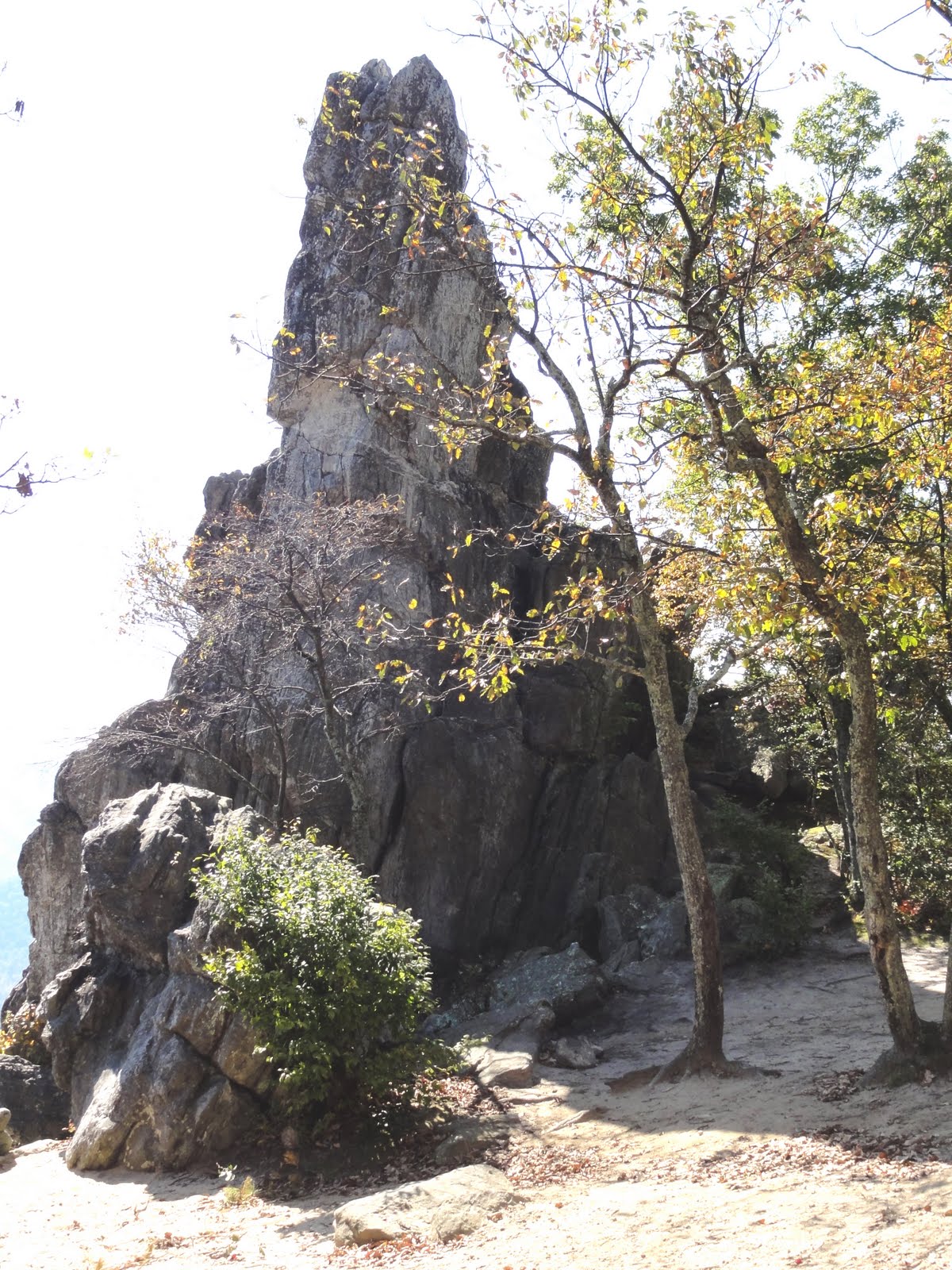 One of the more challenging spots on this section of AT is the climb over "Dragon's Tooth," a jagged granite outcropping. Much of the trail requires hand over hand climbing, scooting along on your butt, and use of the rebar ladders built into the rock. Not so much fun with a 40+ lb. pack on.
In fact, a hiker was severely injured last Sunday by a fall on Dragon's Tooth. There are some nice views indeed but I wonder if the danger is worth it. I was just glad to get down off this thing.
Saturday, October 8, 2011
Virginia Meadows


In between ridge walks are many beautiful isolated valleys, some wooded and others turned for agriculture. These shots were from Wednesday after the weather turned into Indian Summer.
Even though the field walks were hot, I found a sylvan spot beside Sinking Creek for lunch break. Cold stream water for burning feet and a quiet patch to sit. A rare pastoral moment on an otherwise taxing hike.
Owee!!
 Well, did I mention that the trail is really rocky and treacherous in places?
Third day out, a wet and chilly morning. Hiking through a couple miles of trail composed of granite rocks 6"-2' in diameter. Rocks glistening florescent green with moss freshly dampened by rain. BOOM!
Fell on my ass even while taking great caution.
I knew it was pretty bad--snapped one of my hiking poles in half (and they can take some abuse). My right forearm and right thigh took most of the blow. I was just glad I didn't break my arm, hit my head, or tear my rainjacket.
I guess it's good I didn't know how bad it really was or I might not have hiked on another 3 days. When I got to a motel last night and could see myself in a mirror...YIKES! As you can see, my whole right forearm is a bruise. And I have a bruise 6" x 2" on my thigh. Hiking is not all fun and games.

Jefferson National Forest


The hike out from Pearisburg goes into the Jefferson National Forest, a beautiful and remote area along the Virginia/West Virginia border. There's a lot on long ridge walks punctuated by steep, U-shaped valleys. Some parts of the At are smooth and well-designed, while others are really rough. Many of the ridges are composed of broken rock granite spines that make hiking tedious at best. And these Roanoke ATC maintainers need to learn how to build a switchback :) My body has the scars and aches to prove it.
The weather after the first day was chilly and wet--highs only around 40º on the ridges. But by Wednesday the sun was out and temps were at least 20º higher. Water sources remain a problem in the south. Many days hiking were determined by available water, sometimes over 10 miles between.
Friday, October 7, 2011
This Is Why We Hike

Started out from Pearisburg VA on Sun 10/2 on a chilly afternoon. There had been snow flurries the previous night, but as you can see from this view the weather cleared beautifully. The first climb of 1800' didn't seem too bad (thank God) and the reward was a gorgeous 12-13 mile ridge walk along the Peters Mountain Wilderness.
Subscribe to:
Posts (Atom)
